From Kobarid you head down the main road Kobarid–Tolmin and at the end of Kobarid, turn left at the cannon. Follow the road, go straight on at the fork and turn right at the next signpost. Go straight on, through the village of Idrsko, past a stone water trough and then turn right at the second crossroad. Carefully cross the road and continue straight in the direction of Livek. Just a few metres before the turn for Livek you can stop at a private museum collection The Soča Region 1915–1917 located by the main road. After the visit, continue for five kilometres on a tarmac road that ascents to the village of Livek. The village of Livek lies on the border with Italy in the arms of Mt. Kuk and Matajur and during the battles on the Isonzo Front was under Italian occupation. During the breakthrough in October 1917 the area was occupied by the German Army. In Livek you turn left for Kolovrat and after 100 metres, at the Topolovo Trail information board, turn right and follow a marked road that rises slightly in its second part. You cross the border two times on this trail, meandering between Slovenia and Italy. After a good hour of walking you reach the hamlet of Livške Ravne. When you reach the main road you turn right, past the Centre of school and Out-of-school Activities Kavka. You continue your journey on a tarmac road for about a kilometre, when you reach a small parking space on the left side of the road, turn right onto the dirt road. After some hundred metres of dirt road the tarmac starts again. Here you cross the border with Slovenia and Italy. After a few metres of tarmac, you turn left onto a path. After a short climb you reach the top of the Kolovrat Ridge (Mt. Nagnoj 1,193 m). You walk for around an hour along the border ridge and follow the well trodden and marked path all the way to the outdoor museum Kolovrat. Here take the circular trail around the outdoor museum that depicts the renovated Italian third line of defense. The location of the museum offers stunning views of the Julian Alps and the emerald Soča River on one side of the ridge and of the Slavia Friulana, Friuli Plain and the Adriatic Sea on the other.
Outdoor Museum Kolovrat – The Story of War and Peace in the Arms of Nature
Kobarid in the Whirlwind of Centuries
In the vicinity of the Outdoor Museum Kolovrat, on the Italian side, stands the mountain hut Rifugio Solarie, where you can get some refreshments and spend the night.
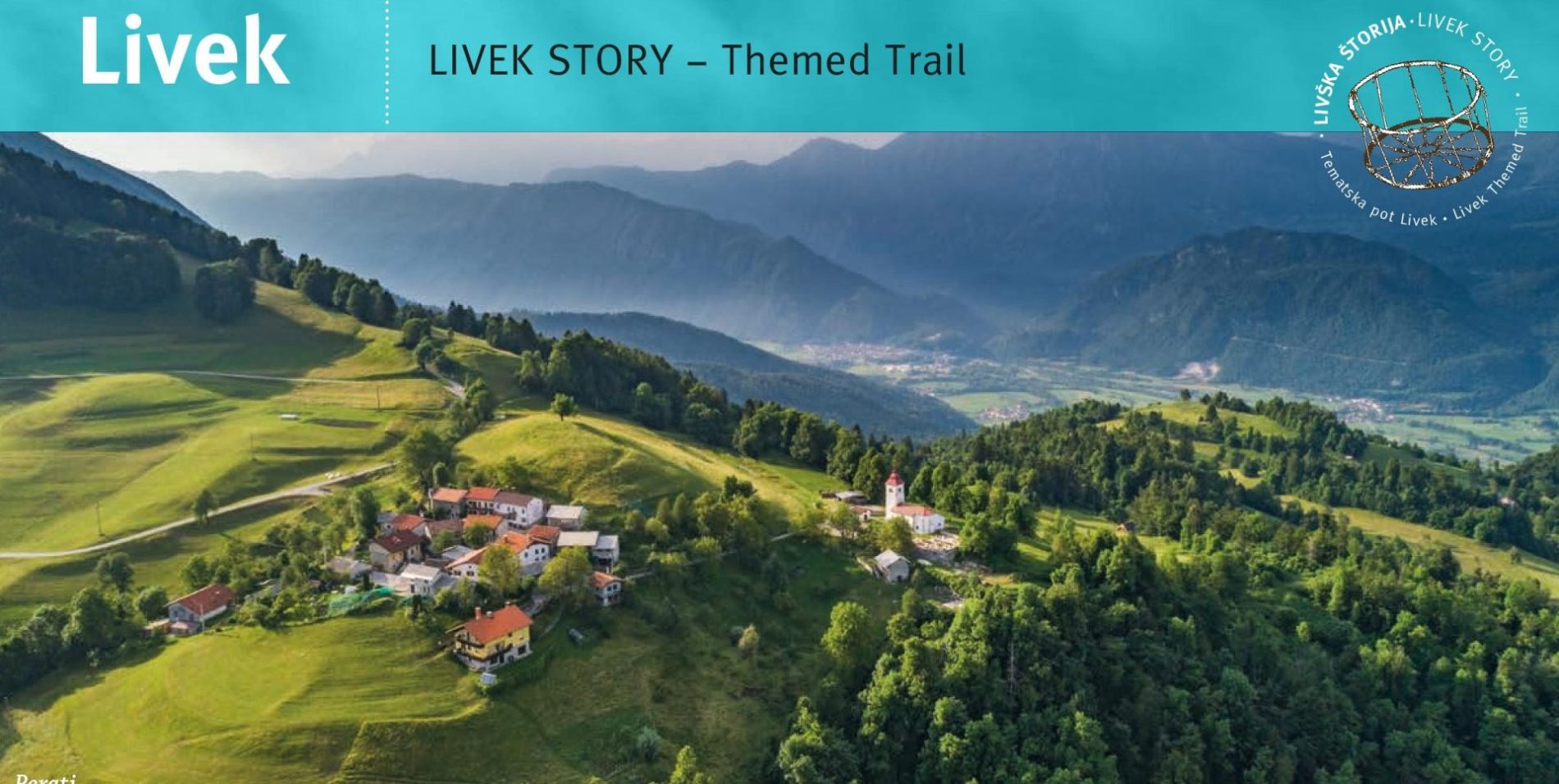
The village of Livek and its surroundings forms a part of a circular Themed Trail – Livek Story with seven interesting locations worth visiting.
Public transport:
Summer bus services:
Kobarid–Kolovrat–Kobarid (Hop on-Hop off)
Parking (start and end point of the stage):
Start: parking area in front of Kulturni dom Kobarid (the cinema)
End: If you decide to finish this stage on Mt. Kolovrat, then you can park by the outdoor museum opposite the Walk of Peace Information Point or you can park by the mountain hut Rifugio Solarie.
Center za obiskovalce Pot miru, Kobarid
(The Walk of Peace Visitor Centre, Kobarid)
Gregorčičeva ulica 8
SI–5222 Kobarid
+386 5 389 0167, +386 31 586 296
turizem@potmiru.si, info@thewalkofpeace.com
www.thewalkofpeace.com
TIC Kobarid
Trg svobode 16
SI–5222 Kobarid
+386 5 380 04 90
info.kobarid@dolina-soce.si
www.soca-valley.com