The stage, rich in historical remains of World War I (and other periods) and boasting a powerful symbolic value, runs along the southernmost part of the Isonzo Front, which the Italian soldiers failed to cross.
From Monfalcone/Tržič you go back to the area of the Kras and the WW1 thematic park Parco Tematico della Grande Guerra, which you can visit if you have not done so during the previous stage.
Once you are on the CAI 81 (between Hill 121 and Hill 85), you walk along this trail towards the motorway which crosses the underpass, after which the area of Lago di Pietrarossa/ Prelosno jezero lake lies on the left. Shortly afterwards, at the fork with the CAI 78, turn right and then right again to the CAI 72 trail, which ascends to Arupacupa/Gorjupa kupa and then descends to the village of Iamiano/Jamlje.
When you reach the state road SS 55, turn right and after 20 metres carefully cross the road. Continue straight on (transverse to the state road) to Via Gruden, turn right and continue to the junction with Via Simon Gregorčič. Turn left here and descend along the road to the village Comarie/Komarji, which lies not far from the state border with Slovenia. Just before the border, the signpost directs you to the right to the CAI 79, where the ascent to Flondar starts, one of the scenes of the last battle on the Isonzo Front prior to the Battle of Kobarid in October 1917. This elevation represents now the dividing line between the Doberdò Carso and the Trieste Carso.
Amid lush vegetation, continue along the trail past the remains of an ancient fort (Castelliere), where the path widens into a macadam road which after about half an hour takes you, if keeping right, to the centre of Medeazza/Medja vas. The main road, running past typical houses of this zone, leads you to the start of the CAI 3 trail, where you can already see the slopes of the fortified area of Monte Ermada/Grmada.
Thus, you are in the area where an important Austro-Hungarian defence line ran and where you can see, if you move a little out of the way, the remains of pillboxes, trenches and defence positions. Leaving the last houses of Medeazza behind, turn right after a few minutes to the CAI 3a trail, which takes you to Monte Cocco/Piciganišče where you can see many pillboxes and other military remains. The path, which ascends slowly but steadily, returns to the CAI 3 trail, and after a sharp left turn leads you to the state border and encircles the north-eastern part of Monte Ermada. When the trail levels, a minor footpath on the left side (be careful, because it is not easily visible!) leads you to the Slovenian territory, to the area of the cave Grofova jama (Grotta del Fuoco). The trail amid vegetation takes you back to Italy to the CAI 3 trail. After a gentle turn to the right and then to the left, the CAI 8 trail branches off and leads you with a few short ascents to the top of Monte Ermada.
After enjoying the view over Monfalcone/Tržič and Vallone di Brestovica/Brestoviški dol, you start descending along the CAI 8 trail and turn left towards Ceroglie/Cerovlje. From there, continue along the road to Malchina/Mavhinje.
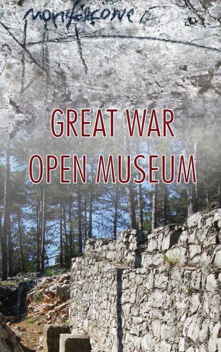
Trieste and its Kras – Austro-Hungarian Rear Areas

Public transport:
Connections to and from Monfalcone/Tržič:
APT Gorizia Bus Lines:
Line G01: Gorizia–Airport–Monfalcone–Grado
Line G03: Gradisca d’Isonzo–San Pier d’Isonzo–San Canzian d’Isonzo-Monfalcone
Line G06: Gorizia–Iamiano–Monfalcone
Line G07: Gorizia–Poggio Terza Armata–Sagrado–Monfalcone
Line G08: Gorizia–San Michele del Carso–Doberdò del Lago–Monfalcone
Line G21: Grado–Fossalon–Staranzano–Monfalcone–Trieste
Line G26: Grado–Cervignano del Friuli–Fiumicello–Monfalcone
Line G51: Udine–Airport–Monfalcone–Trieste
Line G55: Cervignano del Friuli–Monfalcone Cantieri
Monfalcone/Tržič railway station
Line 510
Connections to and from Malchina/Mavhinje:
Line 43 (Trieste Trasporti) change to line 44 for Trieste centre.
Parking (start and end point of the stage):
Start: Monfalcone/Tržič
End: Piazza Malchina, Malchina/Mavhinje
Sistiana Info Point
Sistiana, 56/B
I–34011 Duino-Aurisina (TS)
+39 040 299166, +39 335 7374953
info.sistiana@promoturismo.fvg.it
www.turismofvg.it
IAT Monfalcone
Via Sant’Ambrogio, 21
I–34074 Monfalcone (GO)
+39 0481 282352
turismo@monfalcone.info
www.visitmonfalcone.it
Centro visitatori “Walk of Peace”, IAT Fogliano Redipuglia
(The Walk of Peace Visitor Centre, IAT Fogliano Redipuglia)
Via III Armata, 37
I–34070 Fogliano Redipuglia (GO)
+39 0481 489139, +39 346 176 1913
info@prolocofoglianoredipuglia.it
http://www.prolocofoglianoredipuglia.it/